An introduction to orienteering mapping for the novice
Orienteering map makers often come to mapping through course setting. The course setter discovers early that maps are always in need of updating. At first the course setter usually works with an experienced mapper who helps them with the map updates and corrections for the event they are setting courses for. Their interest grows and they begin to learn the basic skills needed to do their own map updating in OCAD or OpenOrienteeringMapper (OOM). Its only a short step to becoming a novice cartographer (mapper).
Step 1 - Planning
Planning is needed before the mapper goes into the terrain. More than a blank piece of paper is needed before field work can commence. A base map, a template for the recording of field notes, is needed.
Step 2 - The Base map
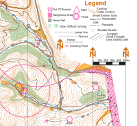
The creation of a base map is the start of the mapping process. The base map is compiled from available resources which include existing maps, aerial photos, cadastral data (property boundaries and roads), and lidar (a source for the generation of contours, terrain graphics and vegetation cover).
Step 3 - Field work
The next step is field work. The field worker takes the base map into the terrain adding their field notes to the base map.
Step 4 - Creating the O map
Step four is the translation of the mapper’s field notes to the base map to create an orienteering map.
Step 5 - Field check
An additional and desirable step is to have the map field checked by experienced third parties.
Key points - the mapper keeps these in mind at all stages
Purpose
The mapper, at all stages of the process, keeps in mind the purpose of the map, which is the main navigation aid for the orienteering competitor. The ideal target user for the map mapper to keep in mind is the elite orienteer, who needs a map that is accurate and very readable when traveling at high speed through the event’s terrain in any weather condition.
Selection, generalisation, exaggeration and simplification
To achieve this the mapper is selective of the key features of the terrain, generalising and sometimes exaggerating detail so that it is an effective navigation tool from a runner’s viewpoint. Simplification is part of this process. An over-detailed map can be confusing to the runner.
Read more
The complete requirements for an effective orienteering map are set out in the IOF standards documents. The novice mapper should acquaint herself with the details set out in the relevant standard (Foot O bush and sprint maps, MTBO, Ski O, etc.). You can find these documents here →.
O-Map Wiki was created in 2021-22 to provide up-to-date and high quality information on orienteering mapping. Tutorial s are being developed. The first one to be posted, on the creation of a sprint map, is an excellent read. You can explore the wiki here .here →
A more detailed document on the cartographic process for orienteering maps can be found here. →
▲
Return to "A Resource for Mappers" Home Page